
Field-Based Science for Coastal Resilience.
I live and work on the First Coast and have seen firsthand how quickly these shorelines are changing. This work isn’t just a job it is what I care about and what I’ve built my career around. My focus is on collecting accurate, field-based data that gives managers and communities a clear picture of what’s happening on the ground. The goal is simple: provide reliable information that supports better decisions and helps strengthen the long-term resilience of coastal systems.
Field Data You Can Act On
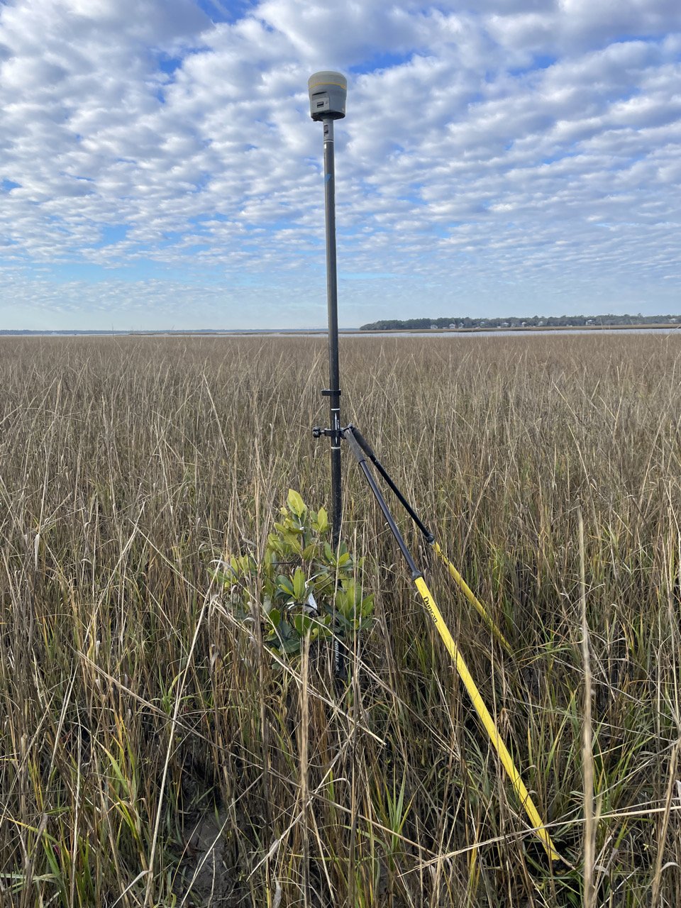
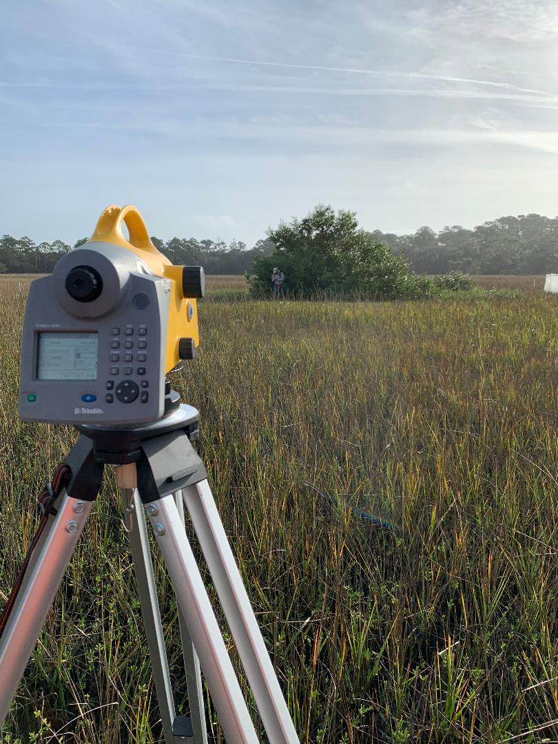
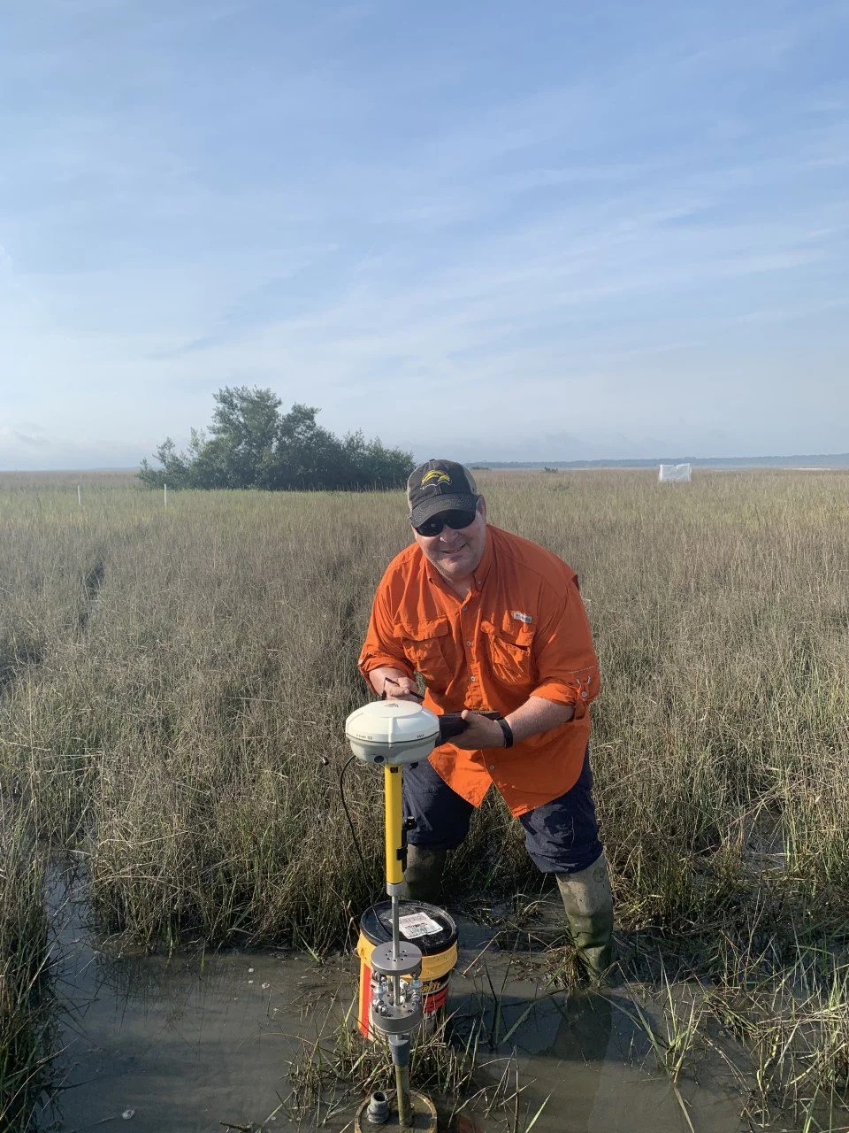
We provide wetland elevation monitoring, shoreline mapping, GNSS surveys, and GIS analysis to deliver precise, field-based data for coastal management and decision-making. From long-term monitoring programs to project-specific assessments, our work is built on consistency, accuracy, and results that stand up to scrutiny.
Built on Observation. Proven in the Field.
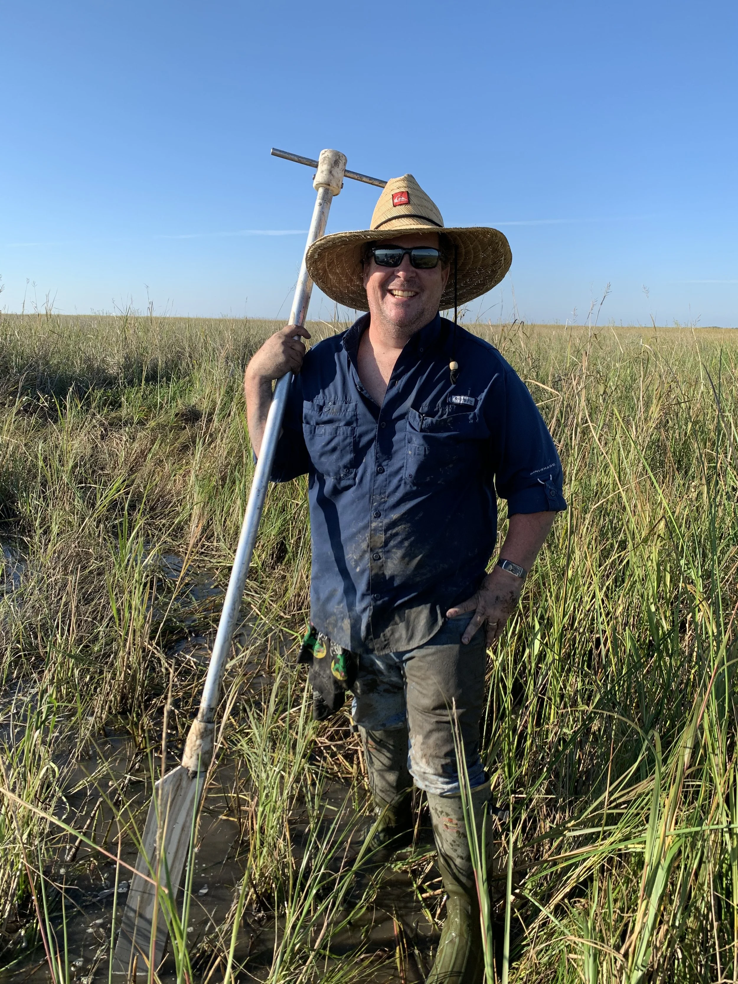
Careful observation is the foundation of every project. We take a field-first approach, focusing on accuracy, consistency, and methods that hold up over time. Data collection is carried out using proven protocols and high-precision equipment, with close attention to timing, site conditions, and natural variability. From initial measurements to processing and final deliverables, each step is designed to produce clear, defensible data that managers and scientists can rely on in real-world coastal environments.
Built on More Than Two Decades in the Field
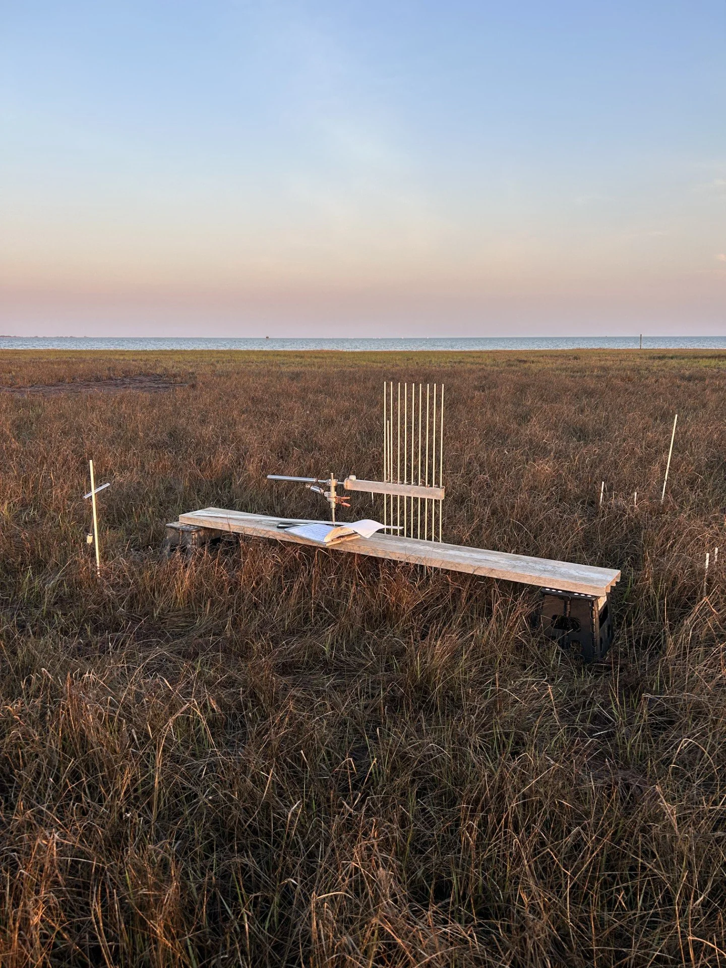
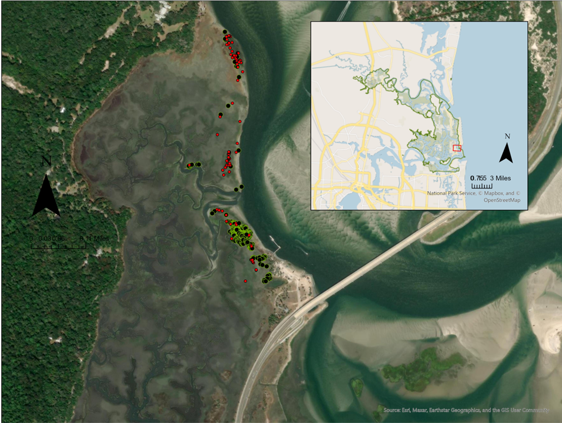
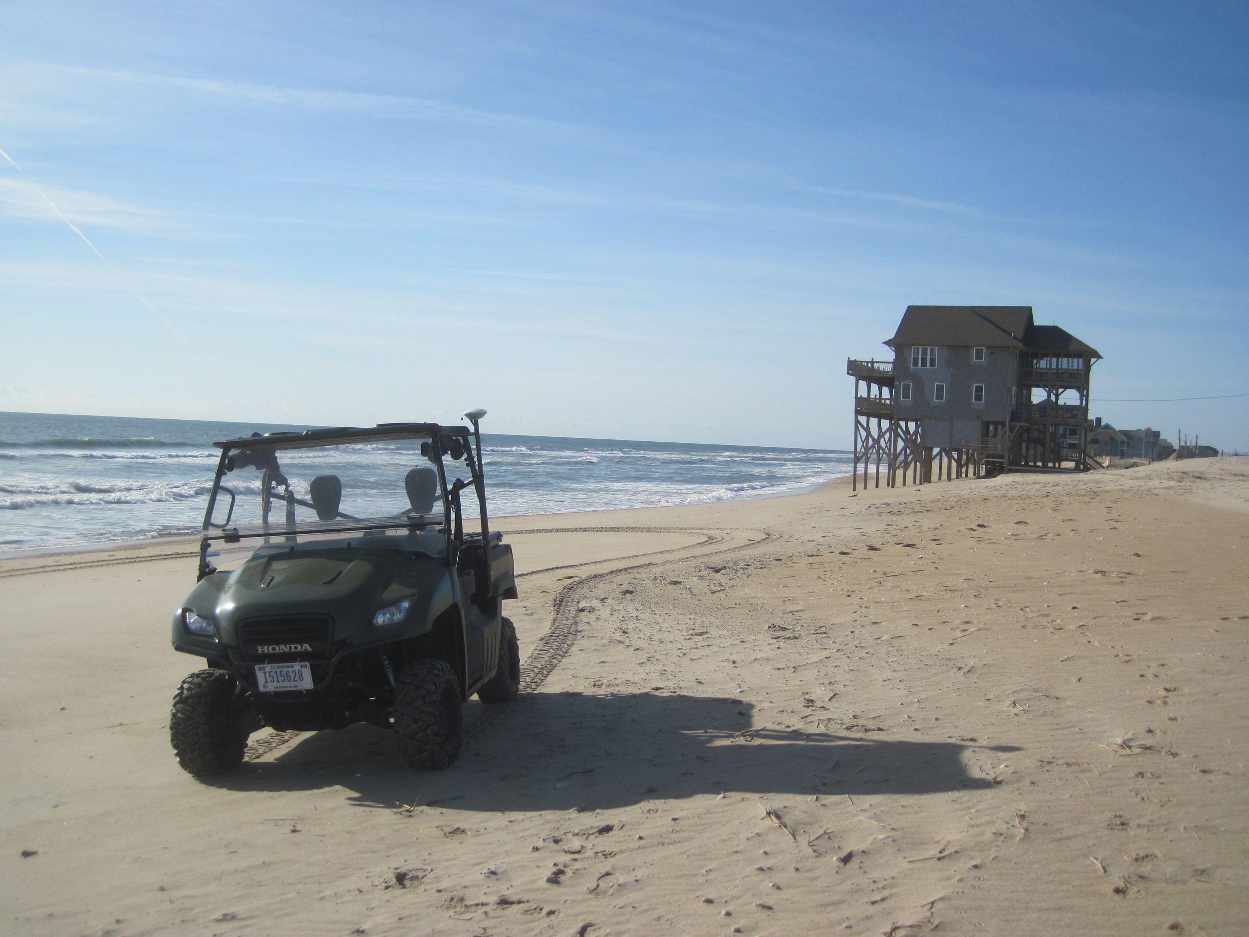
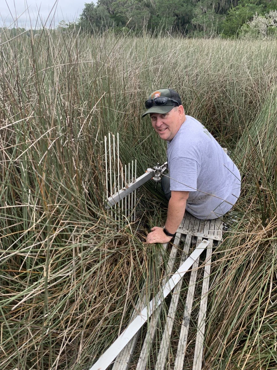
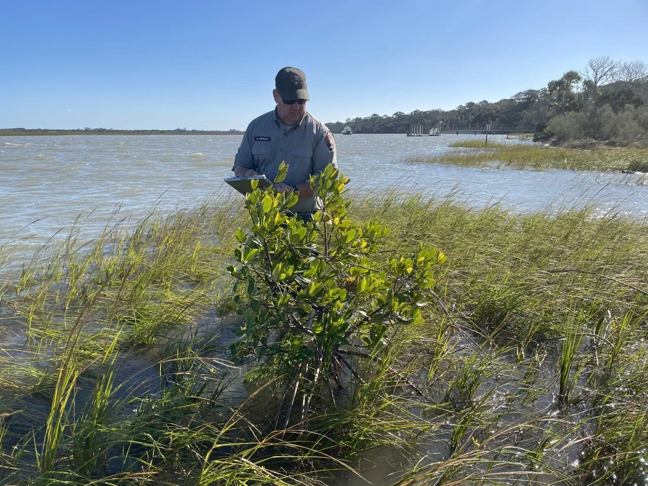
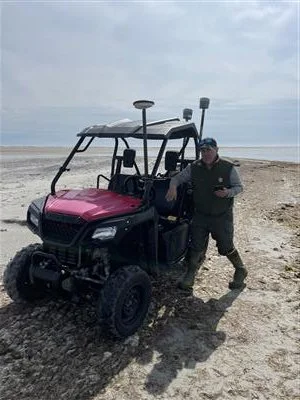
Over the past five years with the National Park Service’s Southeast Coast Inventory and Monitoring Network, work has centered on wetland elevation monitoring, shoreline change analysis, and high-precision GNSS surveys across eight coastal parks spanning from North Carolina to Central Florida. During this time, the wetland elevation monitoring program was reestablished and expanded, improving long-term consistency, data quality, and overall usability across multiple park units. Responsibilities included the installation, routine measurement, and thorough analysis of surface elevation tables (SETs), supporting critical assessments of wetland stability, sediment dynamics, and resilience to sea level rise. In parallel, shoreline monitoring protocols were refined and implemented to strengthen field methods, spatial accuracy, and the development of long-term coastal change datasets. This work supports management decisions in some of the Southeast’s most dynamic and vulnerable coastal environments, where reliable, repeatable field data is essential for adaptive stewardship and planning.
Prior to joining the National Park Service, 18 years were spent with the U.S. Geological Survey, building a strong foundation in field-based science, environmental monitoring, and applied coastal research. Across more than two decades of federal service, the professional focus has remained the same: producing accurate, defensible data and analyses that support informed decisions in complex, changing coastal systems.

Let’s Discuss Your Project
Whether supporting wetland elevation monitoring, shoreline change analysis, or GNSS-based field surveys, every project begins with understanding the site, objectives, and data needs. First Coast Ecological Services delivers accurate, field-based data designed to support real-world coastal management and research.