
Wetland Elevation • Shoreline Change • Coastal Monitoring
Built on Observation. Proven in the Field.
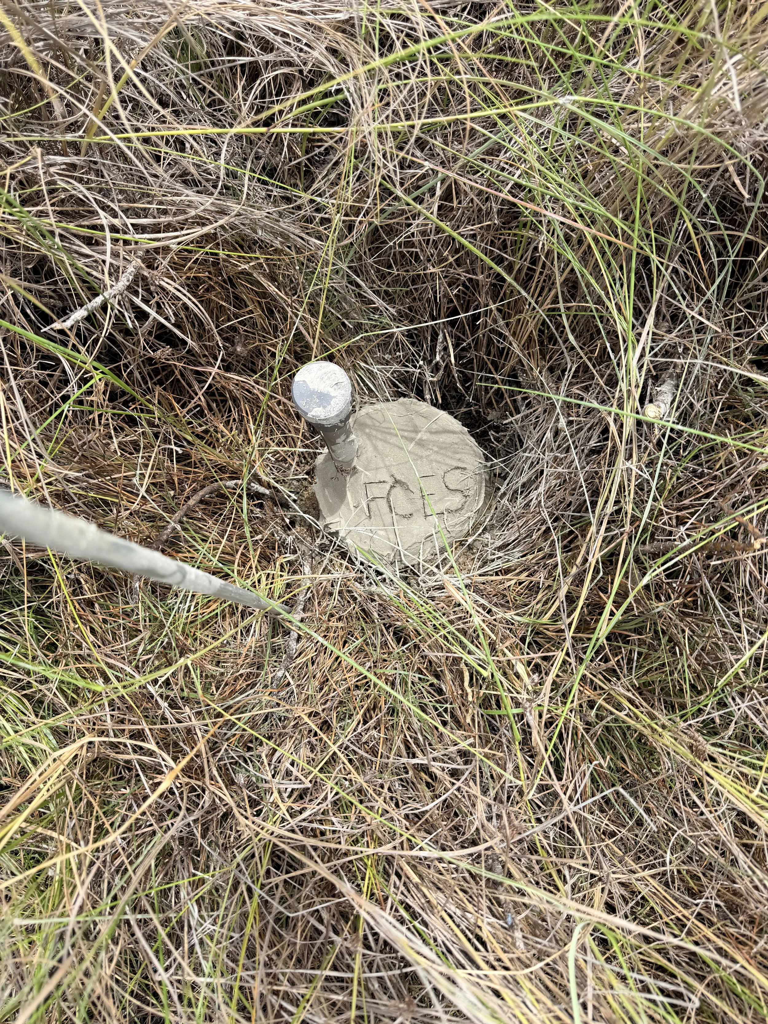
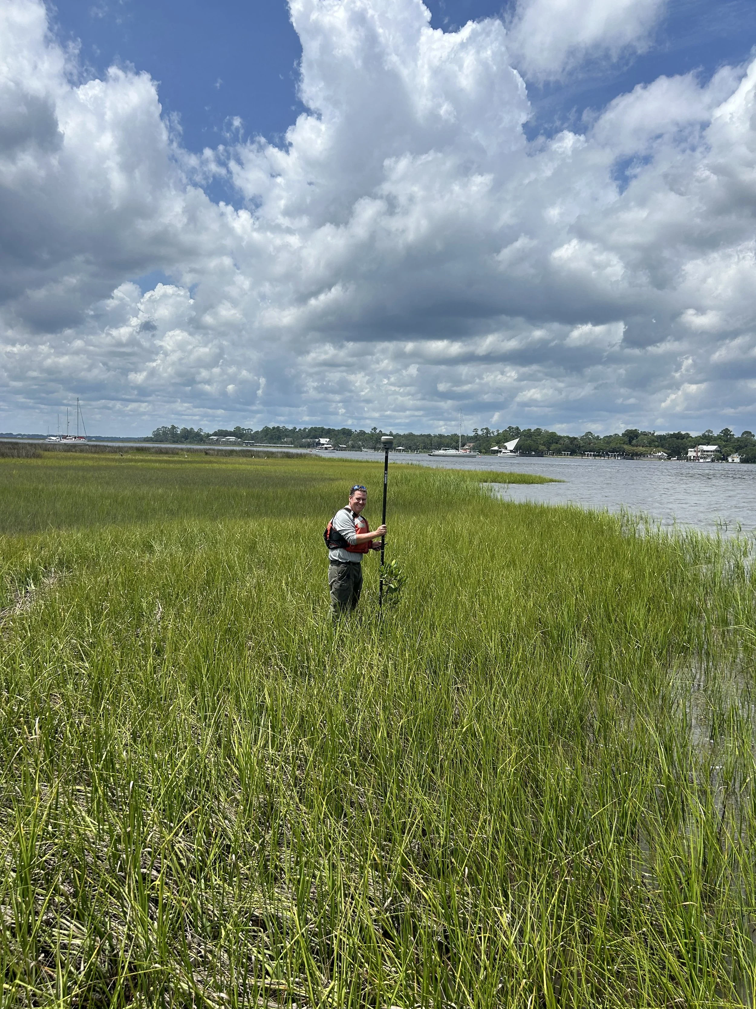
Surface Elevation Table
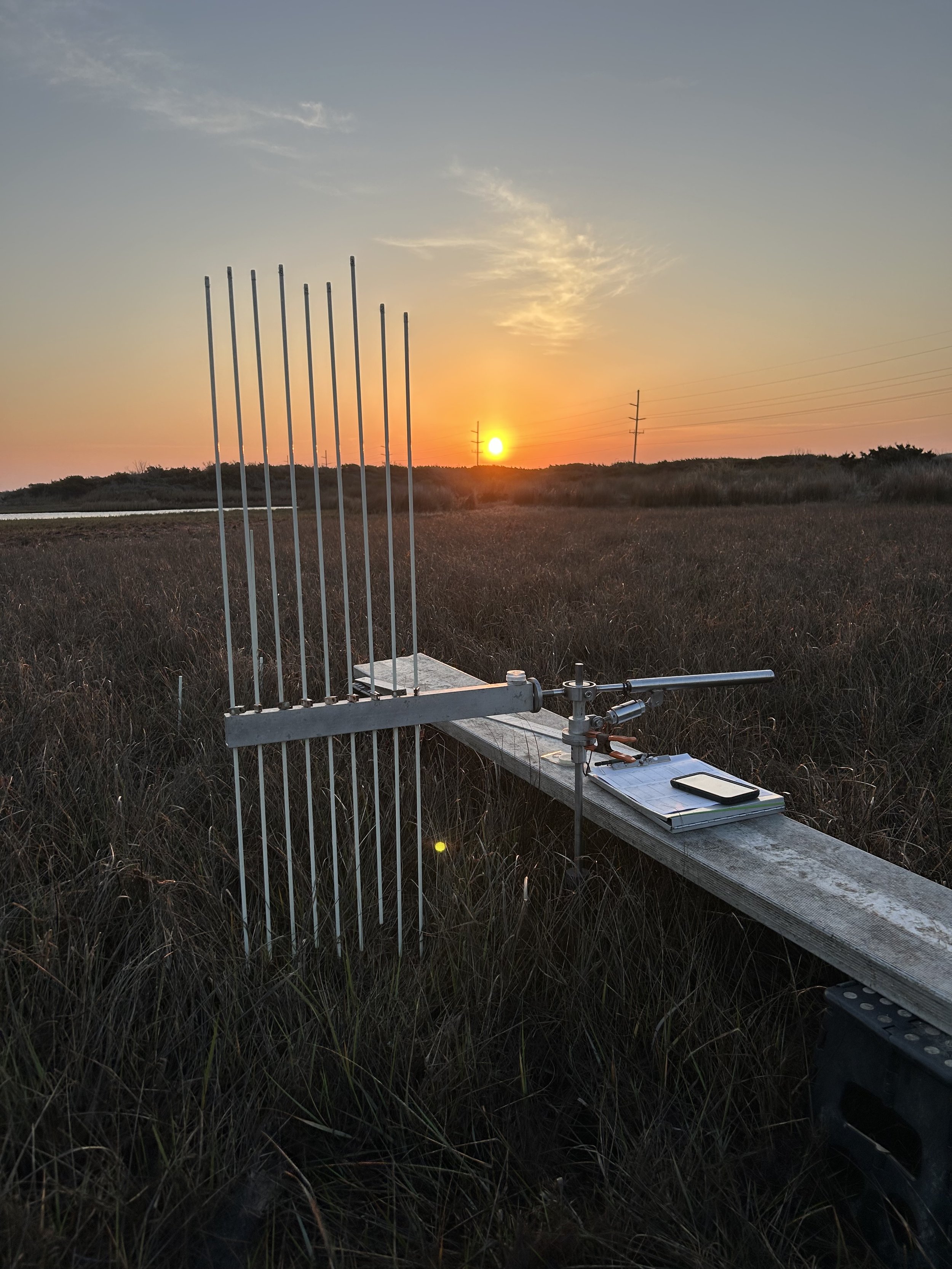
Surface Elevation Tables (SETs) are among the most reliable tools for tracking how wetlands respond to sea-level rise, sediment dynamics, restoration activities, and long-term environmental change. First Coast Ecological Services provides complete wetland elevation monitoring services—from early project planning through long-term data collection, analysis, and reporting. Services include equipment procurement, benchmark installation, SET construction and deployment, routine measurements, data management, QA/QC, spatial analysis, and final reporting tailored to both scientific and management needs.
FCES ecologists have installed more than 150 SETs across diverse coastal environments, from Panama and Belize to the Gulf and Atlantic coasts of the United States. Long-term monitoring and reporting have been conducted for approximately 75 SET stations, supporting projects for the U.S. Geological Survey, National Park Service, and Florida Fish and Wildlife Conservation Commission. These efforts contribute directly to long-term programs focused on wetland vulnerability, restoration effectiveness, and coastal resilience.
FCES SET monitoring projects are grounded in decades of field experience working across some of the most diverse and challenging coastal environments in the Western Hemisphere. From remote mangrove systems in Central America to storm-impacted salt marshes along the Gulf and Atlantic coasts, every project is approached with a focus on defensible methods, consistent data collection, and long-term dataset integrity. FCES work has contributed to several peer-reviewed publications documenting wetland elevation dynamics and long-term coastal change and has been recognized through a Scientific Excellence Award for Coastal Resilience in partnership with the U.S. Fish and Wildlife Service and U.S. Geological Survey. The goal is not simply to measure elevation, but to build the kind of rigorous, continuous record that allows managers, scientists, and policymakers to understand how wetlands are keeping pace with sea level rise and to make better decisions about where and how to invest in coastal resilience.
Learn More About Wetland Elevation Monitoring
Surface Elevation Tables (SETs) are widely used throughout coastal wetlands to measure elevation change, sediment dynamics, and resilience to sea-level rise.
SET stations Installed by FCES: 12
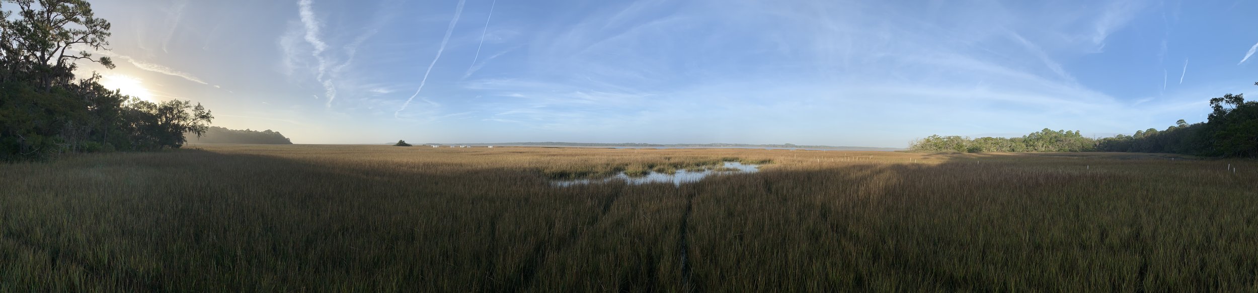
Shoreline Change
Shoreline change monitoring provides critical information for understanding how coastlines respond to storms, sea-level rise, inlet dynamics, human activities, and long-term environmental change. First Coast Ecological Services delivers comprehensive shoreline monitoring and analysis services designed to support coastal management, restoration planning, infrastructure protection, and resilience initiatives. Services include shoreline survey design, GNSS data collection, historical shoreline compilation, shoreline change analysis, GIS mapping, QA/QC, spatial modeling, and technical reporting tailored to both scientific and management audiences.

FCES has extensive experience monitoring dynamic coastal systems throughout the southeastern United States, including barrier islands, estuarine shorelines, tidal marshes, and developed coastlines. Using high-precision GNSS technology, GIS-based workflows, and established analytical methods such as the Digital Shoreline Analysis System (DSAS), FCES produces accurate, repeatable shoreline datasets capable of supporting both long-term trend analysis and post-storm assessments. These efforts help agencies and organizations identify erosion hotspots, evaluate restoration effectiveness, assess shoreline vulnerability, and prioritize management actions. Shoreline change data can also play a critical role in supporting restoration and resilience grant applications by providing defensible baseline conditions, documenting storm impacts, and helping justify funding needs for coastal recovery and protection projects, including FEMA post-storm funding efforts. FCES also supports post-restoration monitoring and analysis, helping managers evaluate project performance over time and determine whether restoration objectives are being achieved under real-world coastal conditions.

FCES shoreline monitoring projects are grounded in decades of field experience working in some of the most rapidly changing coastal environments in the region. From remote undeveloped shorelines to highly dynamic storm-impacted barrier islands, every project is approached with a focus on defensible methods, consistent data collection, and practical results that support informed decision-making. The goal is not simply to map shoreline position, but to provide reliable long-term datasets that help communities, agencies, and resource managers better understand and respond to coastal change.
Precision Mapping
High-accuracy spatial data is the foundation of effective coastal management, permitting, and habitat assessment. First Coast Ecological Services provides precision mapping services using survey grade GNSS equipment and GIS analysis to produce field verified maps of shoreline and coastal wetland environments. Services include shoreline and habitat surveys, site mapping for permit applications, spatial data processing, coordinate system and datum management, map production, and GIS deliverables tailored to agency, regulatory, and project specific requirements. Precision mapping can also play a critical supporting role in grant applications and regulatory submissions by providing defensible baseline conditions, documented site boundaries, and spatially accurate data that strengthens the case for funding and project approval.
FCES has conducted precision mapping across a range of coastal environments throughout the southeastern United States, supporting shoreline change analysis, wetland delineation, and project documentation for regulatory submissions. Using survey-grade GNSS technology and established GIS workflows, FCES produces accurate, repeatable spatial datasets capable of supporting permit applications, restoration planning, habitat assessments, and long-term monitoring programs. These mapping products help agencies and organizations establish defensible site boundaries, document existing conditions, and meet the spatial data requirements of federal and state regulatory processes.
FCES precision mapping projects are grounded in decades of field experience working across some of the most dynamic and complex coastal environments in the region. From tidal wetlands and estuarine shorelines to barrier island systems and developed coastal sites, every project is approached with a focus on accuracy, repeatability, and practical results. The goal is not simply to produce a map, but to deliver reliable spatial data that supports informed decisions. Whether in the field, the permit office, or the grant application.
Let’s Discuss Your Project
Whether supporting wetland elevation monitoring, shoreline change analysis, or GNSS-based field surveys, every project begins with understanding the site, objectives, and data needs. First Coast Ecological Services delivers accurate, field-based data designed to support real-world coastal management and research.