
The First Read: Building a New Wetland Elevation Record at Canaveral National Seashore
FCES returned to newly installed Surface Elevation Table stations at Canaveral National Seashore for their first monitoring read—the moment when field infrastructure begins becoming a long-term environmental record.
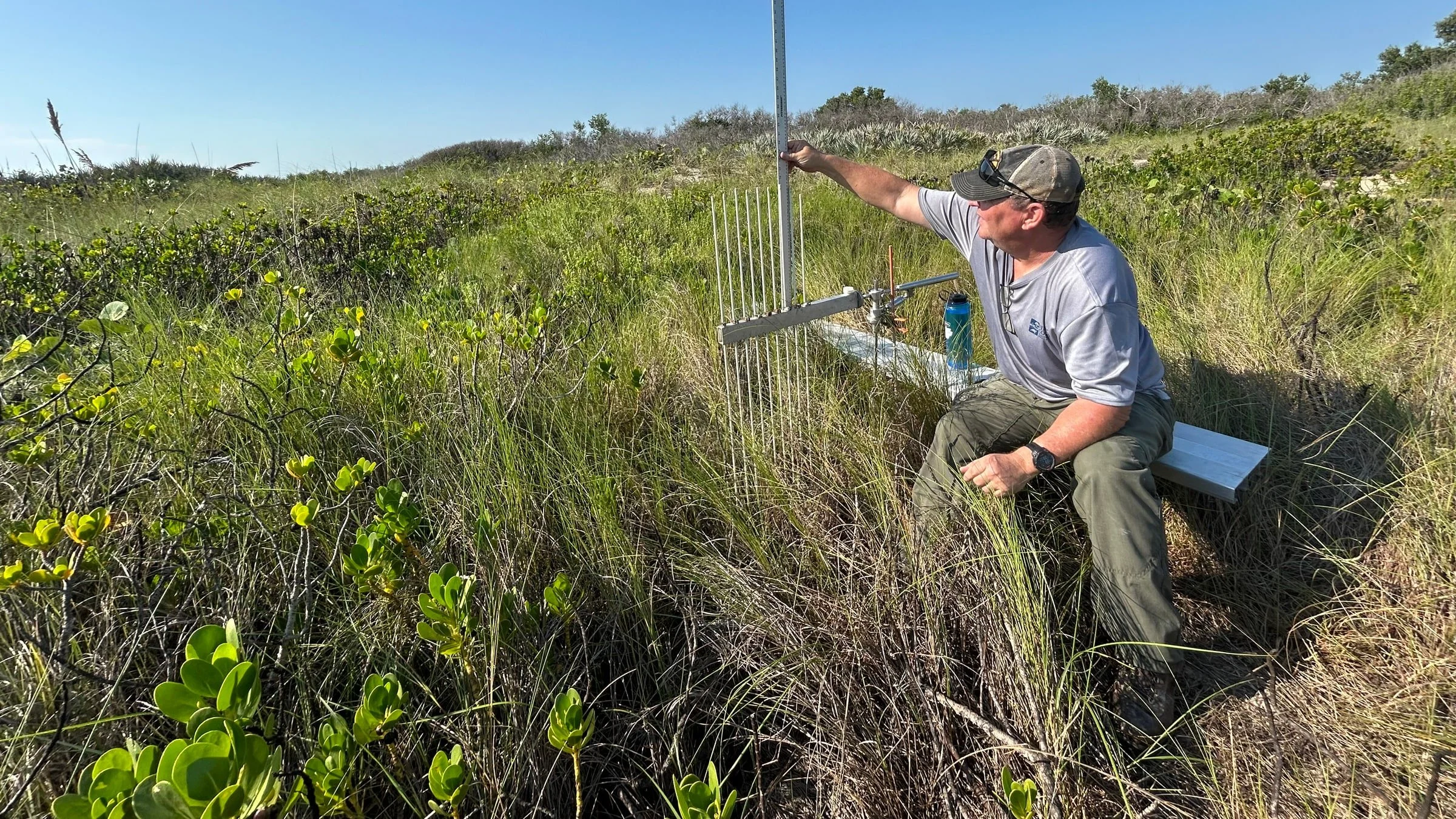
FCES completing the first read at a newly installed SET station at Canaveral National Seashore.
In June, First Coast Ecological Services (FCES) installed new Surface Elevation Table (SET) stations at Canaveral National Seashore (CANA). In August, we returned to complete their first monitoring read.
Installing an SET establishes a stable benchmark. Returning to it with the same equipment, orientations, and measurement protocol is what creates the science.
This first read does not establish a trend by itself. It does something equally important: it begins the repeat-measurement record that future observations will be compared against. It also gives the field team an early opportunity to inspect each station, confirm that the equipment seats correctly, verify repeatability, and establish a consistent workflow for the years ahead.
Measuring change that is difficult to see
Coastal wetlands are always changing, but many of the most consequential changes occur a few millimeters at a time. Those changes are easy to miss during an ordinary field visit and impossible to reconstruct later without a reliable reference.
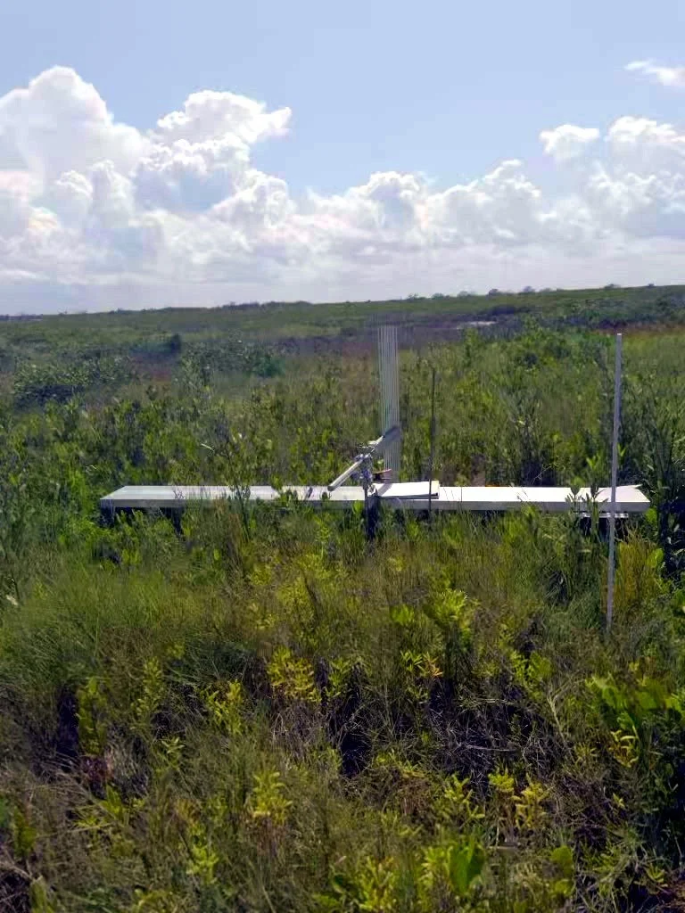
A SET station in the CANA landscape. The removable measurement arm is attached to a permanent subsurface benchmark.
A SET provides that reference. The benchmark is driven deeply enough to remain stable relative to the shallow wetland surface. During a monitoring event, the SET arm is attached to the benchmark in a prescribed position. A series of pins is lowered until each one touches the wetland surface, and the height of every pin is recorded.
Because the same benchmark, arm positions, and procedures are used during each visit, later measurements can be compared with earlier ones at millimeter-scale precision.
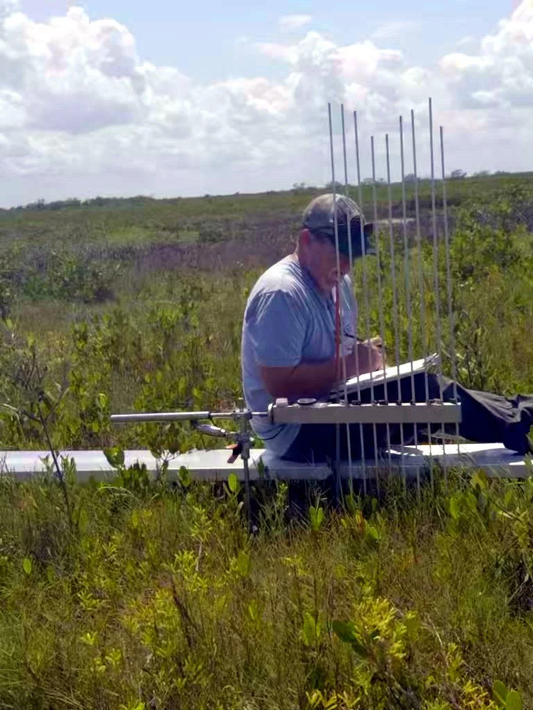
Recording pin heights during the first read. Consistency in equipment placement and field procedure is essential to a defensible long-term record.
Over time, those repeated readings show whether the wetland surface is gaining elevation, remaining relatively stable, or losing elevation relative to the underlying benchmark.
The question is simple to ask and difficult to answer:
Is the wetland surface gaining elevation fast enough to keep pace with changing water levels and relative sea-level rise?
One visit cannot answer that question. A carefully maintained record can.
What SETs and marker horizons reveal together
SET measurements track net change in surface elevation relative to the benchmark. Marker horizons provide a complementary measure of material accumulating at the soil surface.
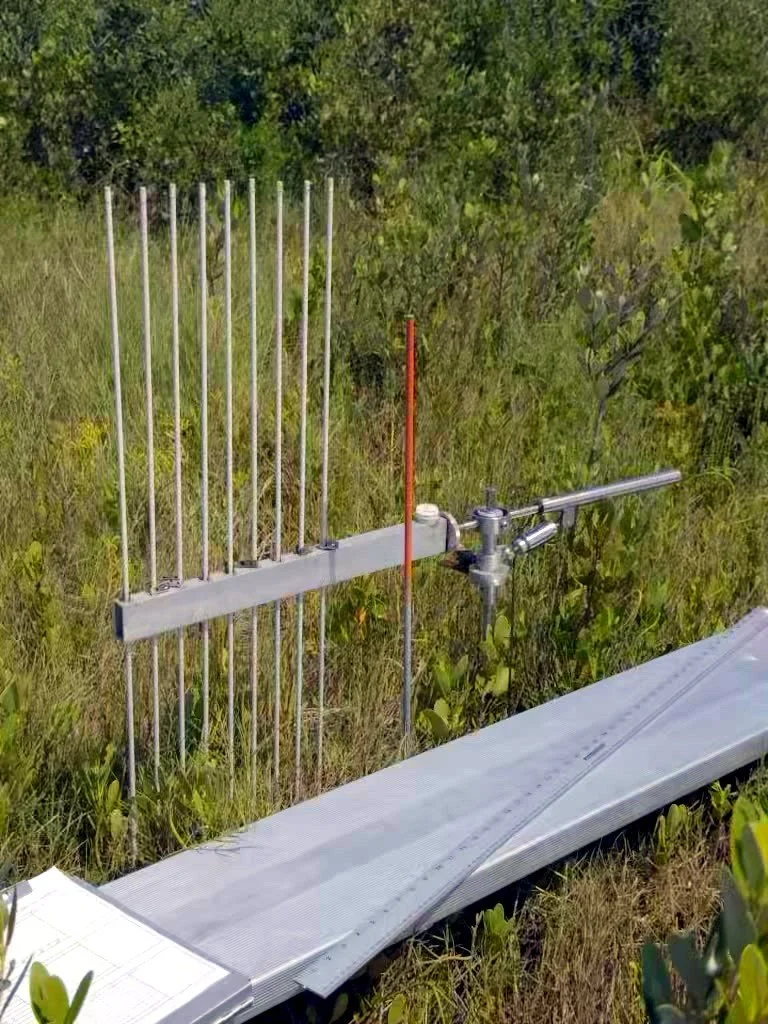
The SET arm and vertical pins translate small changes in the wetland surface into repeatable measurements.
When the two methods are used together, they help separate processes occurring at the surface—such as mineral sediment deposition and organic matter accumulation—from shallow subsurface processes such as compaction, subsidence, root-zone expansion, or swelling.
That distinction matters. A marsh can receive new sediment at the surface and still fail to gain enough total elevation if shallow subsidence offsets that accumulation. Conversely, belowground growth and soil expansion can contribute to elevation gain even when surface deposition is modest.
Together, SET and marker-horizon measurements help explain not only whether a wetland is changing, but how that change is occurring.
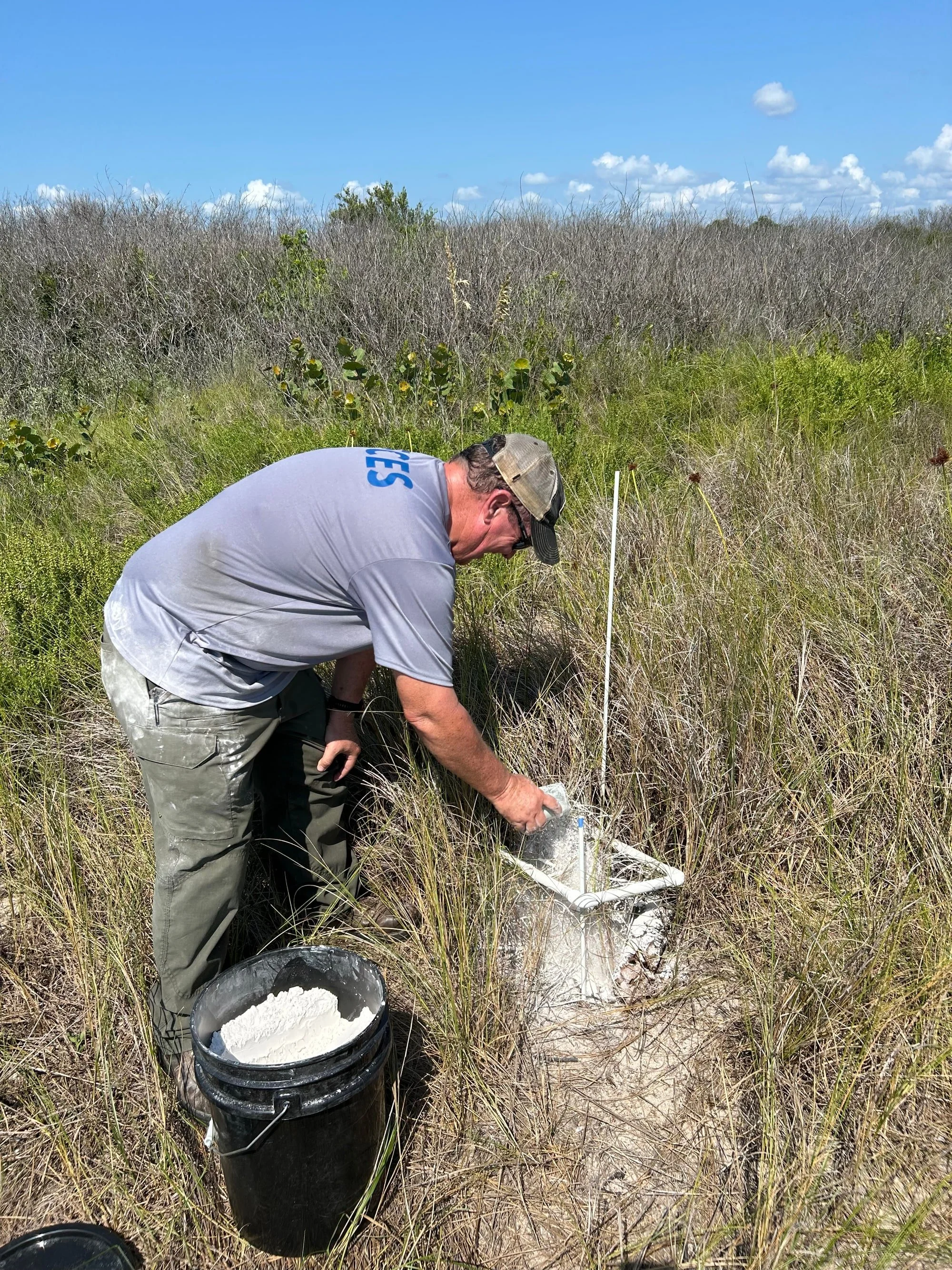
Installing a feldspar marker horizon beside the SET station. Future soil cores can measure the material that accumulates above this visible reference layer.
A new record within a long monitoring tradition
Canaveral National Seashore protects a complex transition among ocean, barrier island, lagoon, and coastal wetlands. The National Park Service reports that salt-marsh elevation monitoring at CANA has been underway since 2014, with measurements focused on surface elevation, accretion, erosion, and the processes driving change. Learn more about monitoring at CANA through the National Park Service.
The new stations installed by FCES add another long-term record to that broader monitoring landscape.
SET monitoring also has a strong scientific track record well beyond CANA. A 2022 study published in Wetlands used SET-marker horizon measurements from 14 coastal marshes across five National Wildlife Refuges in Texas. The researchers documented substantial differences among sites and evaluated the effects of sediment deposition, Hurricane Harvey, shallow subsidence, and relative sea-level rise. FCES founder William C. “Ches” Vervaeke was a coauthor of that research. Read the study through the U.S. Geological Survey.
The lesson from long-term SET programs is consistent: the value is not simply in installing the equipment. It comes from careful installation, repeatable measurements, quality-controlled data, and the commitment to maintain the record over time.
Putting those principles into practice requires continuity from the first site decision through every return visit. Equipment, installation, surveying, field protocols, data management, and interpretation must all support the same long-term record.
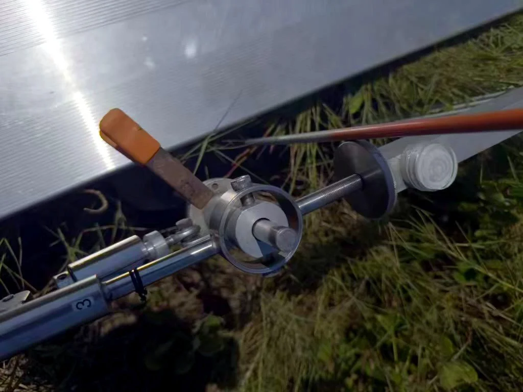
Details matter. Repeatable seating, alignment, and indexing allow measurements from different visits to be compared confidently.
Turnkey SET monitoring from FCES
FCES brings those pieces together in a turnkey SET solution for agencies, universities, conservation organizations, consultants, and research programs that need to establish a new wetland-elevation program or strengthen an existing one.
Support can include:
Site evaluation and monitoring-network design
SET benchmarks, arms, receivers, pins, rods, and field components
Benchmark and marker-horizon installation
Initial and recurring SET measurements
GNSS surveying of SET benchmarks
Existing-station inspection, rehabilitation, and repair
Field protocols, data organization, and QA/QC
Analysis, visualization, interpretation, and reporting
Development and management of recurring monitoring programs
Keeping those responsibilities coordinated matters. A client should not have to assemble separate providers for equipment, installation, surveying, field measurements, database design, and analysis—or discover years later that small inconsistencies have weakened the value of the record.
FCES can carry an SET program from initial planning and installation through long-term monitoring and interpretation. Whether the need is a single three-station site or a regional network, the objective is the same: collect consistent, defensible measurements capable of answering meaningful questions about coastal wetland change.
Learn more about FCES services and turnkey SET monitoring.
One read at a time
The first read at the new CANA stations is complete. There is no trend to announce yet—and that is precisely the point.
Long-term environmental records are built before the change becomes obvious. They begin with a stable benchmark, a documented method, and the discipline to return.
One station. One measurement. One read at a time.
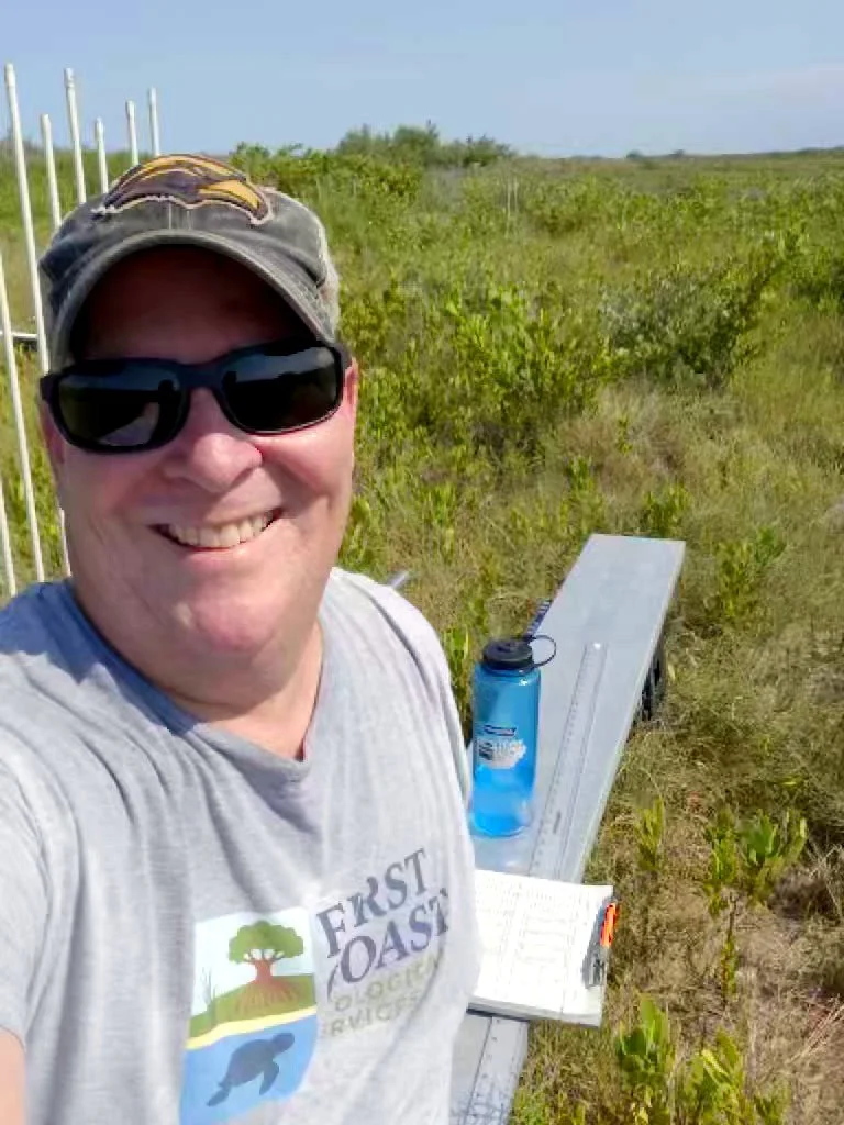
Fieldwork complete at one of the new CANA stations. The first read begins the record; consistent future measurements give it meaning.
First Coast Ecological Services provides field-based coastal science throughout Florida and the southeastern United States, including turnkey SET programs, GNSS surveying, shoreline-change analysis, wetland monitoring, GIS, and coastal data analysis.
Planning a new SET network or trying to restore value to an existing one? Contact FCES.
